Urban Stormwater Runoff
 Nearly 40% of Massachusetts is considered urban, making it the fourth most urbanized state in the country
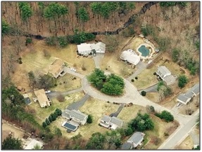
 (2010 U.S. Census). Urbanization drastically changes the hydrology of our watersheds by increasing the amount of surface runoff due to impervious surfaces (roads, parking areas, sidewalks, roofs, etc.) and conversely reducing the amount of groundwater recharge and base flow to rivers.
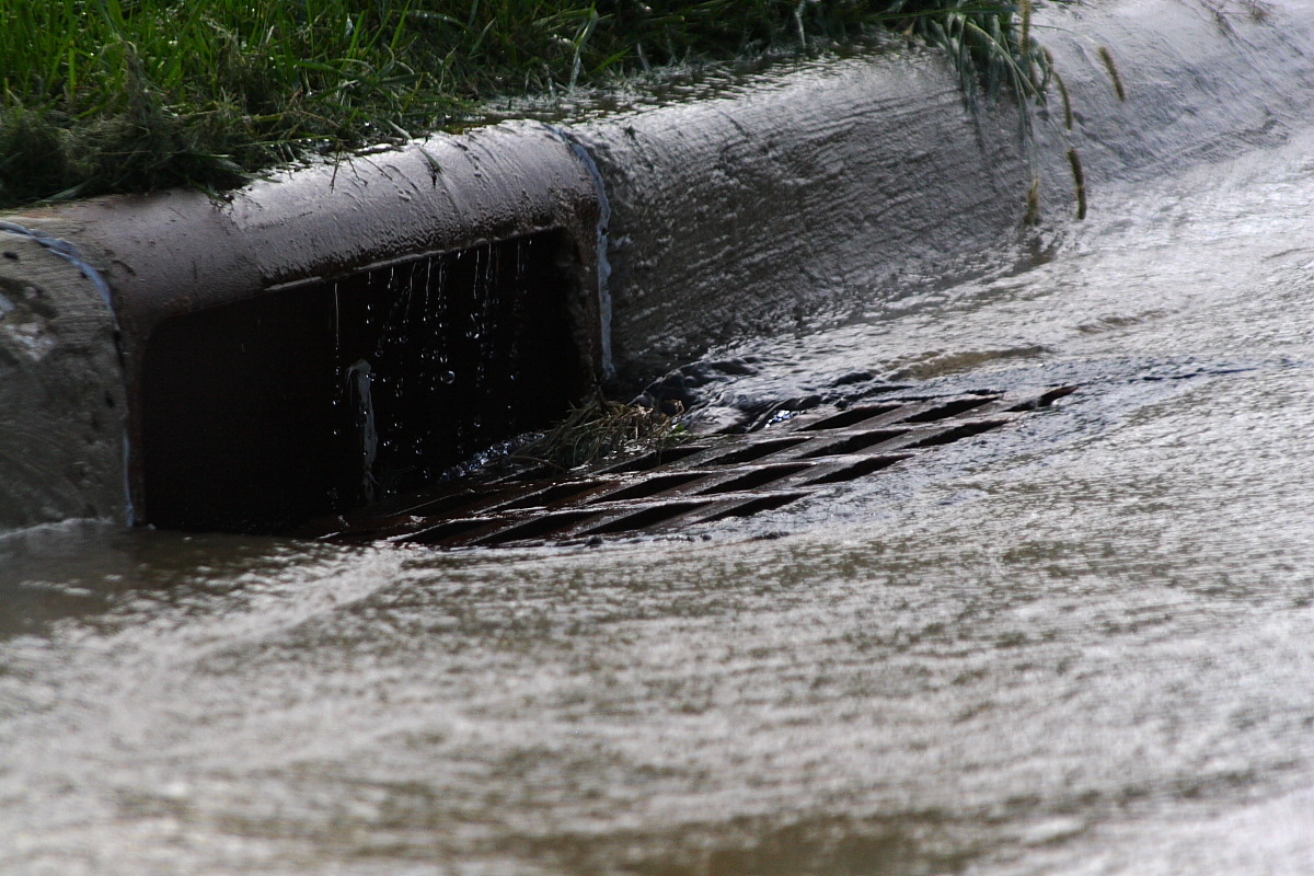
Urbanization begins with construction and removal of trees, vegetation, and topsoil. These natural features play an important role in allowing rainfall to slowly infiltrate and provide recharge to streams, wetlands and aquifers. Development replaces natural conditions with impervious surfaces that generate large quantities of surface runoff. This runoff is often collected on roadsides, directed into catch basins, and discharged to the nearest stream, pond or wetland.
Conventional drainage systems, typically comprised of catch basins, discharge pipes and associated structures, prevent water from flowing into the ground and filtering through the soil before ending up in surface or groundwater. Stormwater runoff from urban areas may carry a variety of pollutants from nonpoint sources throughout the watershed, including sediment, organic matter, nutrients, metals, pathogens, fertilizers and pesticides. The increased volume of water will flow faster and carry more sediment at higher flow rates, which can destabilize streambanks and increase flooding.
Urban Watershed Hydrology
Most of Massachusetts receives about 45 inches of precipitation annually. Under naturally vegetated conditions, only 10% of this (4.5 inches) will result in runoff. As the figure below illustrates, the amount of runoff is more than five times higher in highly urbanized areas. Depending on the degree of watershed imperviousness, the annual volume of storm water runoff can increase by 2 to 16 times its pre-development rate, with proportional reductions in groundwater recharge (Schueler 1995).
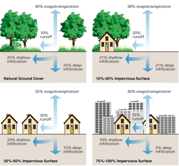
Relationship between impervious cover and surface runoff: Impervious cover in a watershed results in increased surface runoff. As little as 10 percent impervious cover in a watershed can result in stream degradation and will carry large amounts of pollutants. From: Stream Restoration: Principles, Processes and Practices (FISRWG 1998).
Urban Stormwater Pollutants
Pollution in urban environments comes from a variety of sources. The primary sources of pollution in urban environments are described below. Stormwater is exposed to these sources as it flows over driveways, roads, parking areas, industrial sites, lawns and rooftops. In the case of septic systems, pollutants can enter the groundwater and eventually surface water bodies.
Sediment
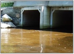
Sediment is the loose sand, clay, silt, and other soil that settles to the bottom of a waterbody. The U.S. Environmental Protection Agency lists sediment as the most common pollutant in rivers, streams, lakes, and reservoirs. While natural erosion produces nearly 30 percent of the total sediment in the United States, erosion from human use of land accounts for the remaining 70 percent.
Sedimentation includes accumulations of clean sediments as well as sediments contaminated with pollutants from spills, legacy anthropogenic activities, or high levels of nutrients. Sediments may be located in rivers, streams, lakes, bays, and wetlands or accumulated behind structures such as dams or canals.
Sedimentation is a natural process, but increased levels of sediment in waterbodies is a water quality concern. Both the physical and chemical properties of sediments can cause water body impairments. Sediments can smother critical aquatic habitats, cause physical harm to aquatic organisms, and adversely affect drinking water supplies, water supply intakes, and permitted outfalls. In addition to the physical problems associated with sediment deposition and buildup, sediment particles readily transport other pollutants such as nutrients, metals, and pathogens.
Nutrients
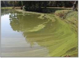
In regard to water quality, the term "nutrients" refers to primarily to nitrogen and phosphorus. While these nutrients naturally enter waterbodies through the processes of organic matter breakdown, human activities can greatly increase the amounts of these nutrients. Of particular concern is nutrient runoff from lawns, fields, and other areas where fertilizers may be used in excess.
For most freshwater ecosystems in Massachusetts, phosphorus is the essential plant nutrient which is in shortest supply relative to the growth needs of plants and algae. As the "limiting nutrient", increases in its supply will directly increase plant and algae abundance. In saltwater coastal ecosystems, nitrogen is typically the limiting nutrient.
Nutrients move relatively easily from upland areas to waterbodies. Nitrogen readily dissolves in water and is often directly transported from lawns through storm sewers. Phosphorus is less soluble in water, but readily attaches to soil particles, allowing it to enter waterbodies through sediment run-off.
Increased nutrient runoff can produce visible and harmful effects, including:
- Ingesting excessive levels of nitrate (a form of nitrogen often found in fertilizer) from drinking water can cause serious illness and sometimes death. In infants, the conversion of nitrate to nitrite by the body can interfere with the oxygen-carrying capacity of the child’s blood.
- High nutrient levels (particularly phosphorus) in freshwater lakes and streams can promote excessive plant and algal growth. Blooms of potentially toxic cyanobacteria (also known as "blue-green algae") can result in impairments to drinking water supplies, recreational water uses, and aquatic habitat.
- When aquatic plants and algae die, decaying vegetation depletes the water's oxygen supply. This can stress or result in the death of fish and other aquatic organisms. This phenomenon can occur in stagnant streams, small ponds, or across larger waterbodies.
Pathogens
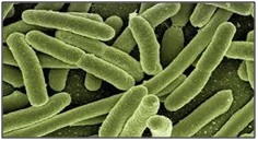
Waterborne pathogens are disease-causing microorganisms, including bacteria, viruses and pathogenic protozoa. Pathogens are found in the feces of humans, pets, livestock and wildlife. These sources can contaminate water bodies via surface runoff, septic system failures, combined sewer overflows, etc. When transmitted to humans, pathogens can cause a wide range of illnesses, such as gastro-intestinal illness, Giardia, and Norwalk virus.
Oil and Grease
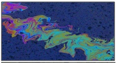
Oil and grease pollution is caused by leaky car and truck engines, oil and grease spills at gas stations, or when oil and grease have not been disposed of properly. During periods of rain and snowmelt, these pollutants are transported directly into surface and groundwater.
Car Washing/Metals/Road Salt
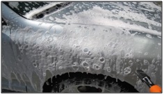
Metals such as lead and copper can be found in urban runoff at concentrations that can be harmful to aquatic and human health. Road salts can also be a major pollutant in both urban and rural areas. Snow runoff tends to carry salt, which contains high concentrations of sodium and chloride, into water bodies. Car washing on impervious surfaces can result in metals, salts, and detergents directly entering water bodies. These pollutants often result in adverse ecological responses as they negatively affect aquatic biogeochemistry (USEPA, 1995).
Debris, Litter and Waste
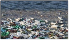
Debris pollution can result from a variety of sources such as food containers, household wastes, and grass and shrub clippings. Debris associated with infrastructure industries, such as construction materials, can contribute to the pollutant load from these types of practices (USEPA, 1995).
Urban Stormwater Control Resources
Massachusetts Erosion and Sediment Control Guidelines for Urban and Suburban Areas: A guide for planners, designers and Massachusetts municipal officials.
http://www.mass.gov/eea/docs/dep/water/essec1.pdf
Massachusetts Stormwater Handbook: MassDEP publication including the Massachusetts Stormwater Management Standards, stormwater BMP information, and information related to regulatory compliance.
http://www.mass.gov/eea/agencies/massdep/water/regulations/massachusetts-stormwater-handbook.html
Massachusetts Smart Growth/Smart Energy Toolkit: Includes a variety of educational materials relevant to planning and building in the urban areas, including Low Impact Development, Open Space Design, Natural Resource Protection Zoning, etc.
http://www.mass.gov/envir/smart_growth_toolkit/pages/SG-modules.html
Massachusetts Rivers Protection Act (RPA): The RPA creates a 200-foot Riverfront Area that extends on both sides of rivers and streams. In certain urban areas, the Riverfront Area is 25 feet.
http://www.mass.gov/eea/agencies/massdep/water/watersheds/rivers-protection-act-q-and-a.html
Managing Urban Runoff: This USEPA web page includes fact sheets, guidance documents, manuals and research studies.
http://www.epa.gov/region1/npdes/stormwater/assets/pdfs/BMPRetrofit.pdf
International Stormwater BMP Database: Website with a database of over 500 BMP performance studies, tools for use in BMP performance and monitoring studies, and related publications.
http://www.bmpdatabase.org/
Stormwater Best Management Practices Guidance Document: Boston Water and Sewer Commission, 2013.
http://www.bwsc.org/ABOUT_BWSC/systems/stormwater_mgt/Stormwater%20BMP%20Guidance_2013.pdf
Low Impact Development (LID) Toolkit: The LID Toolkit includes a variety of fact sheet on LID techniques, model bylaw language and an LID codes checklist.
http://www.mapc.org/low-impact-dev-toolkit
Massachusetts Stormwater Technology Evaluation Project (MASTEP): This University of Massachusetts-Amherst website provides verified technical information on stormwater BMPs.
http://www.mastep.net/#
University of New Hampshire Stormwater Center: A research, testing and educational facility providing a technical resource for water managers, planners, and design engineers.
http://www.unh.edu/unhsc/about
MassDOT Complete Streets Funding Program:
http://www.massdot.state.ma.us/highway/DoingBusinessWithUs/LocalAidPrograms/CompleteStreets.aspx
Best Management Practices for Urban Stormwater Runoff
Many of the BMPs listed below are focused on retrofitting, which involves the replacement or improvement of existing stormwater infrastructure with newer technologies or practices. However, there is still a good deal of land development occurring in Massachusetts, and there are a variety of BMPs that can be implemented in new developments to address problems before they can occur (see Low Impact Development fact sheets).
Fact Sheet Links